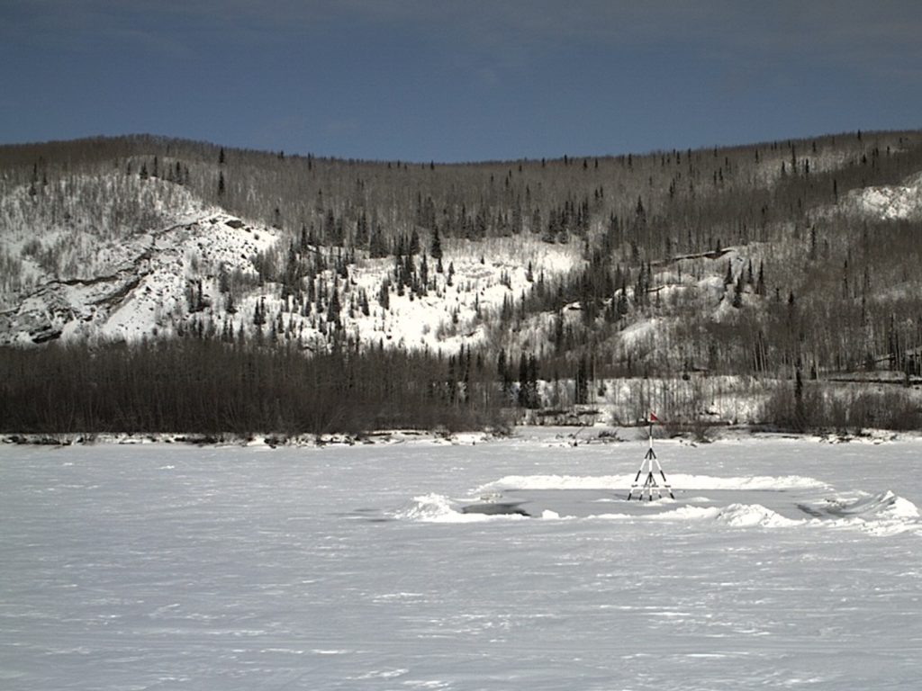
Ice thickness at this time of year in Alaska is no flawless predictor of how breakup will go on the major rivers, but at least it’s an indicator. As March ends, the ice thickness on the Yukon River is 25 inches, three inches less thick than last March, and four inches thicker than in 2021. In other words, in spite of a snowy winter, the ice thickness is pretty average.
The thickest ice on a river in the state, as of now, is the Tolovana River below Rosebud Creek, which measured 60 inches this month, about the average for this time of year. The Tolovana River ice is measured south of Livengood.
Chena Lake, south of the boat ramp in Fairbanks, has 38 inches of ice, a bit above the average, which is 32 inches.
Cottonwood Lake in Anchorage is covered in 24 inches of ice, about 80% of what is normal for the lake this month.
On Lake Hood, the world’s busiest seaplane base, the last measurement taken was Feb. 11, and the ice was between 22 and 27 inches thick in various places.
Visit the University of Alaska Fairbanks’ “Fresh Eyes on the Ice” website at this link.

In Nenana, the Nenana Ice Classic organization measures the ice with greater frequency as spring arrives in the north. The guessing game, which has prizes, is to wager when ice will flow out and tip the tripod set up on ice at the Tanana River at Nenana. Last year’s tripod tipped over on May 2. Ice near the tripod was 26.3 inches thick on Monday, after hitting a likely season high of 32.3 inches on March 21.
To view the map an ice conditions on lakes and rivers around Alaska, visit this National Weather Service ice map.
The Weather Service’s breakup map is at this link.
The Weather Service forecast for breakup will be updated March 29. For now, the outlook is appearing to be average, with a higher-than-average potential for ice jam flooding on the Upper Yukon river, due to freeze-up ice jams that resulted in jumbled ice that is thicker than normal.
Ice jam and snowmelt flooding potential in the Upper Tanana River Base and areas of the Copper River Basin is also above average due to a well-above normal snowpack.
The Kuskokwim River is sporting thinner ice than average due to an early-season snow and mild start to the winter.
The Weather Service says that the cumulative freezing days, which can be an indicator of ice thickness, is near normal statewide, while snowpack is above normal for much of the state. Both are factors in how quickly lake and river ice will melt.
“The FortyMile River, which flows into the Yukon River upstream of Eagle is at 150% of normal, with Mt Fairplay at 165% of normal, and Chicken, Boundary, and Three Fingers sites all near 150% of normal. The Tanana River basin average is approximately 140% of normal, with the outliers of Tok and Chisana near the Canadian border at 200% and 175% of normal, respectively. The Middle Yukon River basin, from Fort Yukon to Galena, is at approximately 130% of normal as reported by nine stations. Data are available for two stations in the Koyukuk basin; Bettles in the southern Brooks Range and Coldfoot to the northeast reported 120% and 84% of normal, respectively. Four sites on the Lower Yukon, downstream of Galena, reported approximately 120% of normal,” the Weather Service reports.

Cottonwood Lake is in Wasilla, and I believe the Ice is a bit thicker.
I wish I had been here to comment on this when the article was fresh.. Ice thickness is only one component of breakup character: Ice condition, solar exposure, snowpack and the speed of melt are all factors. Another one not so obvious is changing air pressure. Koyukuk River ice has not broken until after the main culvert in Bettles is flowing freely for the last 30 years…
Democrats are controlling the ice thickness-they want to control everything.