

According to data provided by the National Oceanic and Atmospheric Administration, Juneau’s sea level is dropping fast, about 4.41 feet every 100 years. Those with property that touches the ocean along the coast are ending up with more land, as time passes.
Those who live in Juneau know this to be the case, and scientists have a name for it: Glacial rebound, when the earth’s solid surface rises after glaciers melt, bouncing back from the weight the ice had put on the land. This scientific name for this is “glacial isostatic adjustment” or “isostatic rebound.”
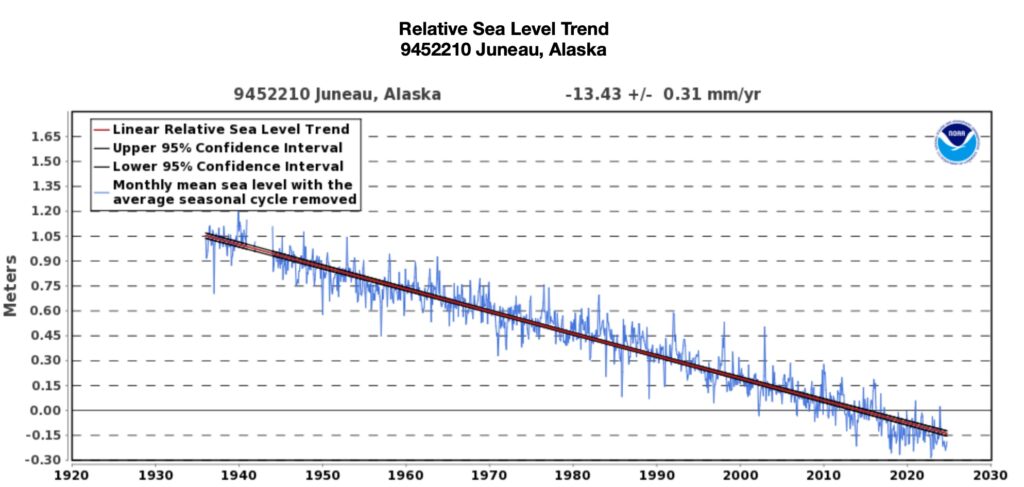
“The relative sea level trend is -13.43 millimeters/year with a 95% confidence interval of +/- 0.31 mm/yr based on monthly mean sea level data from 1936 to 2023, which is equivalent to a change of -4.41 feet in 100 years,” NOAA reports about the change seen in Juneau, where the measurements are taken near the Coast Guard station in the support area of downtown.
Here’s the Juneau water level chart provided by NOAA though 2023:
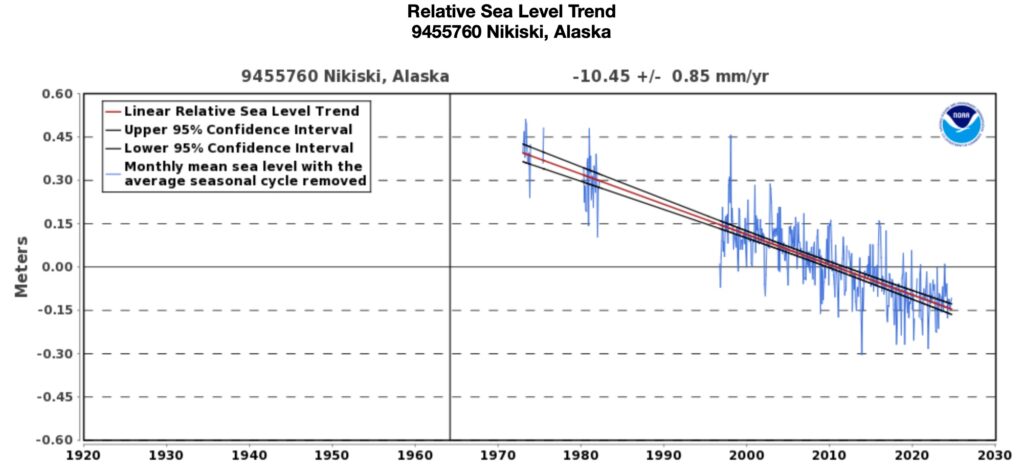
In Nikiski, on the Kenai Peninsula, the relative sea level trend is -10.45 millimeters/year with a 95% confidence interval of +/- 0.85 mm/yr based on monthly mean sea level data from 1973 to 2023, which is equivalent to a change of -3.43 feet in 100 years.
Here is the Nikiski water level chart:
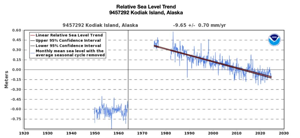
In Kodiak, the chart is interrupted by the 1964 Alaska earthquake, but still shows the relative sea level trend is -9.65 millimeters/year with a 95% confidence interval of +/- 0.7 mm/yr based on monthly mean sea level data from 1964 to 2023, which is equivalent to a change of -3.17 feet in 100 years.
Not all parts of the Alaska coastline show such a dramatic change. Prudhoe Bay, for instance, shows an ever-so-slight increase in water level.
The ocean, like all water, will find low spots to fill in and the changes in river deltas also creates variable conditions, as explained by NOAA about the data in Westen Alaska.
The biggest impact is the retreat of the Little Ice Age, a period from the 13th to 19th centuries when glaciers advanced. During the time of 1300 to about 1850, glaciers covered up to one third of Alaska. Now, however, only about 5% of Alaska’s land is covered by glaciers. Juneau, sitting so close to the Juneau Icefield and Mendenhall Glacier, is experiencing routine flooding from dammed up water alongside the glacier, a condition that has developed as the glacier retreated.
“A negative trend does not mean the ocean surface is falling; It indicates the land is rising more quickly than the ocean in a particular area. Trends close to zero indicate the land is rising at nearly the same rate as the ocean,” NOAA says.
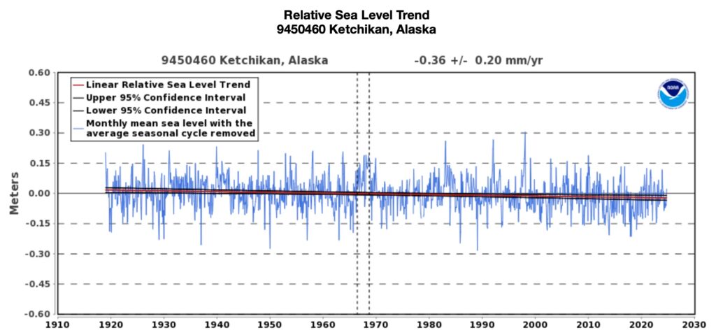
Ketchikan shows only a slight drop in sea level during the observation period. It may have experienced glacial rebound earlier than Juneau and earlier than monitored by scientific methods.
You can explore more locations and look at the charts provided by NOAA at these links:
