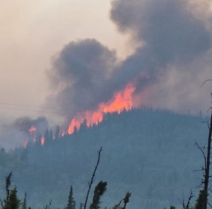
Wildfires across Alaska surged in activity Friday into Saturday, prompting expanded evacuations, road closures, and the arrival of new incident management teams. Below is a summary of the major active fires and impacts:
Bear Creek Fire (#237) – 21,210 acres
- Location: Near Parks Highway, south of Anderson
- Status: Explosive growth from 4,001 to over 21,000 acres; crossed the Parks Highway.
- Response: Multiple air tankers, helicopters, ground crews, heavy machinery deployed. An Alaska Complex Incident Management Team is assuming command Sunday.
- Evacuations:
- Level 3 “GO!”: June Creek Subdivision, Bear Creek Subdivision, multiple properties between MP 264-270, and the Kobe Road area.
- Level 2 “SET” & Level 1 “READY” extend north and south around the area, including Clear Space Force Station and City of Anderson.
- Highway Impact: Parks Highway was temporarily closed; now open to one-lane traffic with pilot car escort. Expect smoke and long delays.
Saint George Creek Fire (#246) – 285 acres
- Location: Near Bonnifield Creek, north of Gold King
- Status: Burning on both sides of the creek; threatening remote cabins.
- Response: Structure protection underway; aerial and ground support continues.
Bonnifield Creek Fire (#208) – 2,675 acres
- Status: Under the same management as Bear Creek and Saint George Creek fires.
Bonanza Creek Fire (#238) – 1,599 acres
- Location: South of Parks Highway near MP 332
- Status: Active fire behavior pushed growth from 500 to nearly 1,600 acres.
- Evacuations (Fairbanks North Star Borough):
- Level 3 “GO!”: Skinny Dick’s Logging Road, MP 330–333
- Level 2 “SET”: MP 325–330 and MP 333–338
- Level 1 “READY”: Areas including Old Nenana Highway and Standard Creek Road.
Goldstream Creek Fire (#270) – 80 acres
- Location: North of Parks Highway MP 322
- Status: Spreading east; not currently threatening structures.
Himalaya Road Fire (#223) – 1,868 acres
- Location: Near Elliott Highway MP 15
- Status: Crossed fuel break Saturday; tankers engaged to slow spread.
- Other fires in group:
- Aggie Creek Fire (#268) – 934 acres
- Washington Creek Fire (#232) – 5.7 acres
- Evacuations:
- Level 3 “GO!”: All roads on Haystack Mountain
- Level 2 “SET”: Hayes Creek Neighborhood, Poker Flat Watershed
- Level 1 “READY”: At Your Own Risk, Chatanika
Gilmore Trail Fire (#233) – 15.5 acres
- Location: East of Fox
- Status: No growth on Saturday; mop-up ongoing.
- Evacuations: READY and SET levels still in place.
Twelvemile Lake Fire (#220) – 6,221 acres
- Location: Northeast of Delta Junction
- Status: Gained over 4,000 acres Friday. Structures potentially threatened within 48 hours.
- Other fires in area: Lake George Fire (#224), Sand Lake Fire (#292)
- Response: Structure protection via air, ground, and boat-supported delivery of kits. Residents asked to use caution due to increased activity.
Evacuation & Public Safety Notes
- Evacuation Checkpoint: Tri-Valley Community Center – Call (907) 378-7985 for info.
- Travelers: Watch for smoke, equipment, and crews on and near highways. Expect delays.
- Airspace: No flight restrictions currently near Twelvemile Lake but conditions may change rapidly.

Praying for rain !
I heard this morning Bear Creek fire is getting some rain