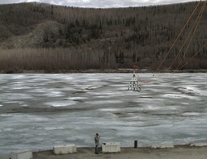
The ice on the Tanana River is thinning, but the tripod at Nenana still stands. Breakup might be a few days later than normal this year for the Nenana Ice Classics ticket holders.
As Alaska braces for the annual spring breakup, the National Weather Service has issued a comprehensive forecast indicating a dynamic season ahead. With temperatures expected to remain below normal, particularly in the western regions, and a robust snowpack persisting across northeastern and western Alaska, the stage is set for a potentially eventful breakup period that could include flooding.
Conditions hint at a dynamic breakup in certain areas, and forecasters note that the circumstances are not as favorable as the preceding year’s historic breakup season.
The 2023 season was characterized by numerous significant ice jams and snowmelt floods across the Interior. The potential for localized flooding remains contingent on air temperatures staying cold through the end of April and into early May.
Dynamic breakup, distinguished by cold early spring air followed by rapid warming, could be compounded by above-average headwater snowpack and river ice thicknesses. This type of breakup typically moves downstream in a somewhat linear fashion and is more prone to ice jam flooding.
Ice thickness across the state is reported to be near normal as of April 1, with certain regions exhibiting above-average snowpack. Notably, the Porcupine, Yukon, Lower Kuskokwim, and Copper basins are experiencing well-above-average snowpack levels. However, the interior snowpack is notably less compared to the past two years.
The North Slope region, in particular, has witnessed record-breaking winter precipitation, indicating an above-average snowpack north of the Brooks Range. Conversely, observations in Southcentral Alaska indicate a mix of normal and above-average snowpack levels.
Looking ahead, the climate outlook for the coming weeks suggests a transition from enhanced ridging to moderate troughing over the eastern Bering Sea and Arctic Ocean, potentially leading to below-normal temperatures in the western half of the state and above-normal temperatures in eastern Alaska.
As breakup timing is evaluated based on historical median breakup dates and current conditions, forecasters anticipate breakup to occur slightly later than usual, with western and southwest Alaska expected to experience a delay of 1-4 days.
The National Weather Service underscores the importance of vigilance and preparedness in the face of potential flooding risks. Village flood potential assessments are continuously reassessed based on evolving outlooks and conditions, with the Experimental Product providing detailed estimations of snowmelt runoff volume, flood potential, and forecast breakup dates for various locations across the state. More information is posted at https://www.weather.gov/aprfc/breakupProducts.
The next Spring Breakup Outlook will be published by NWS on April 26.